

1. What is 3D Laser Scanning?
Have you ever wondered how to “copy” an ancient building, a complex forest, or even an entire city into
computers? 3D laser scanning is the technology that makes it possible. Utilizing lasers, we can collect
massive data without physically reaching objects in a short time, building a “digital twin” of the real world.
Its accuracy and efficiency have made it a vital tool in fields ranging from architectural surveying and terrain
modeling to cultural-heritage preservation and smart city development.
2. What is Point Cloud?
Laser scanners collect millions of data points that come together like countless droplets to form a 'point cloud'
—a vast and complex digital representation of an object or space. It is the core output of 3D laser scanning.
Each point is more than just a dot in space; it contains precise coordinates (X, Y, Z) and can also include rich
data like laser reflectance intensity, true color, and even classification labels. Common point-cloud file formats
include .las, .xyz and .pts. Serving as a “container” for 3D data, these files let us reproduce every subtle
contour of real objects in virtual space.
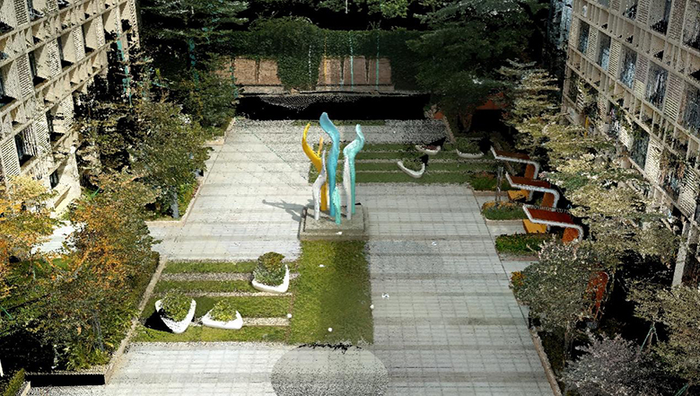
The architectural point cloud data collected using RUIDE SPL-1500
3. Three Major Scanners Kinds to Meet Different Scenarios
RUIDE has wide range of laser scanning product line to cover diverse application scenarios. Depending on
the mounting platform, 3D laser scanners can be divided into the following three categories:
A. Terrestrial Laser Scanners
B. Mobile Scanning System
C. SLAM Scanners
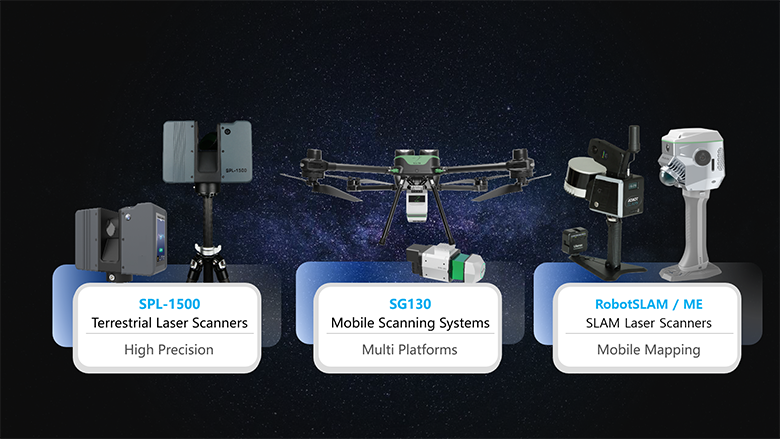
RUIDE’s laser scanners product line
Terrestrial Laser Scanners (TLS): Usually set on the ground, TLS normally have the best accuracy among
the three types of scanners and an exceptional long range. RUIDE SPL-1500 delivers millimeter-level
accuracy with high-definition color cameras (12.3 MP x2) and up to a 1500 meters range to produce
high-quality true-color point clouds even in complex environments. Benefiting from this, SPL-1500 is most
suitable for detailed scans such as building facades, tunnel structures, and factory interiors.
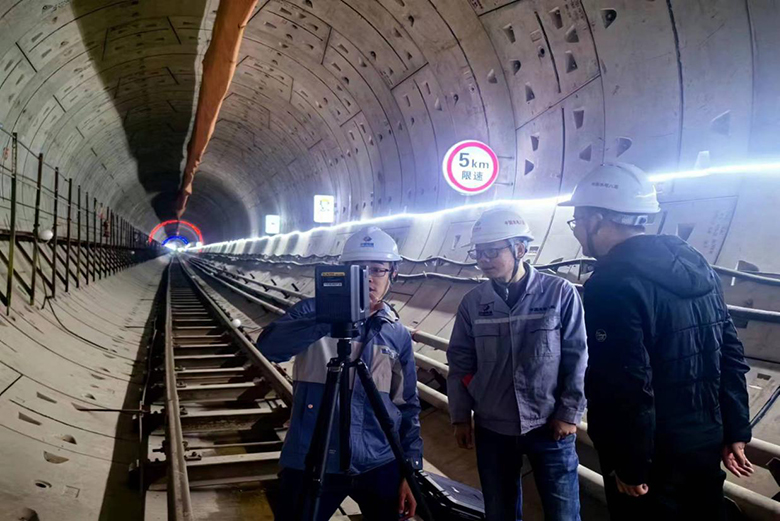
Using SPL-1500 for subway tunnel construction projects
Mobile Scanning System: Mounted on drones or vehicles, the system can quickly cover large areas for
terrain surveying and surface model reconstruction. RUIDE SG130 Lidar System integrates high-precision
GNSS and IMU modules and features a maximum range of 1800 meters. With its ability to capture
centimeter-level point clouds over wide regions, it can help you overcome the challenges of large-area
mapping. SG130 is ideal for power-line inspection, water conservancy, forestry surveys, and other applications
with vast working areas.
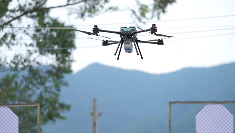
The mobile scanning system is taking off to perform topographic surveying
SLAM Scanners: Lightweight and agile, SLAM scanners are commonly operated by one hand. Held by
surveyors, they are more flexible for mobile indoor/outdoor scanning and confined spaces. Products such as
the Dotlas and ME series combine SLAM and RTK technologies for real-time positioning and mapping,
enabling robust data capture even without GNSS signals. The 1 1>2 combo are well-suited for building
interiors, mines and plant sites, and emergency surveying.
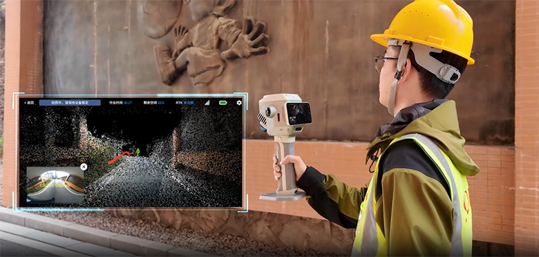
ME is conducting outdoor building facade collection
4. One-stop Platform for Easy Point-cloud Preprocessing
Data acquisition is only the beginning — the quality and efficiency of point-cloud processing determine the
final outcome. A typical point-cloud preprocessing workflow includes data import, quality check, registration,
multi-source fusion, point-cloud refinement, detail adjustment, final product generation and data export.
RUIDE’s self-developed software, AcuteLas Studio, integrates an entire set of point-cloud processing steps
on one single platform. In addition, industrial tool sets for power, mining, and other continuously expanding
applications greatly simplify processing and reduce time costs, helping you complete full-workflow
laser-scanning projects more efficiently.
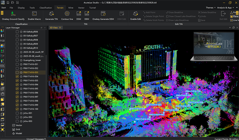
The point cloud data processed using AcuteLas Studio
5. Conclusion—Efficient Digitalization Solution for the Real World
Beyond the scanner itself, 3D laser scanning provides a comprehensive solution, turning raw measurements
from the field into valuable insights and ready-to-use project deliverables like 3D models and drawings.
Achieve a complete, end-to-end surveying solution. Our ecosystem combines versatile hardware—from
high-precision terrestrial scanners SPL-1500 and efficient mobile scanners SG130 to flexible SLAM and its
hybrid devices Me & Dotlas—with our one-stop processing platform, AcuteLas Studio, to capture
everything from the finest detail to the widest terrain. Contact us for sample data or schedule a live demo—
let us help you turn the visible world into valuable data.


