

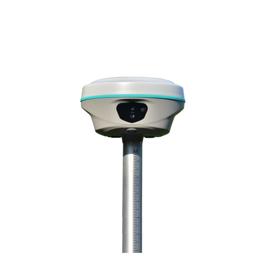
RAMA2
Designed to Break Cliches
A blend of imagination, ability and flexibility
Video: How to Perform Laser Measurement
https://www.youtube.com/watch?v=l6aCwg6Fwo4
Video: How to Perform Photogrammetry Measurement
https://www.youtube.com/watch?v=aFHLXaB1sMQ
Video: How 3D Modeling Works
(https://www.youtube.com/watch?v=xsjFOBd9IQ4)
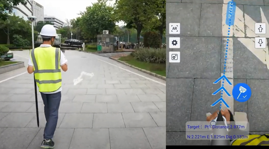
Video: How Dual-Camera Stakeout Works
https://www.youtube.com/watch?v=xPYBVUQJTcs
RAMA2 is Designed, styled and engineered with a blend of bold imagination, extraordinary work ability and amazing flexibility.
There are so many no-compromise reasons to choose RAMA2, from the intelligent design of software, long-range measurement capability, diverse surveying mode offering, to the overall quality, durability, and the industry-leading reliability of the brand and its distributor lineup.
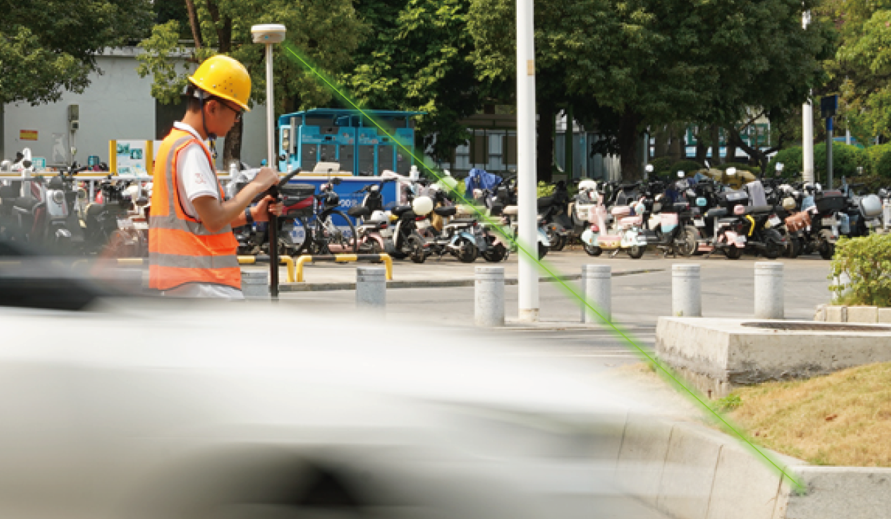
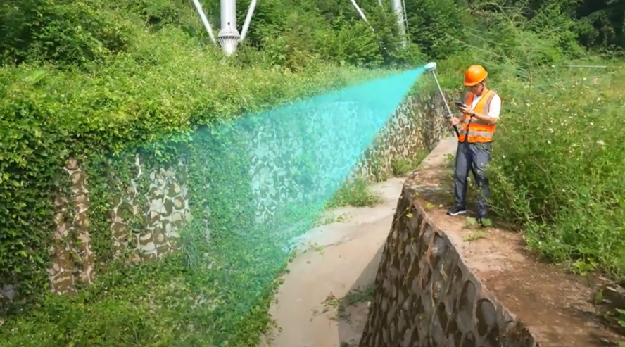
The all-new laser measurement way is 20% even more efficient than you'd get from a traditional GNSS RTK. And it kicks in the instant you press the button on controller app, to measure the target that you were difficult to reach before. Until you experience it, you won't know what the future holds.
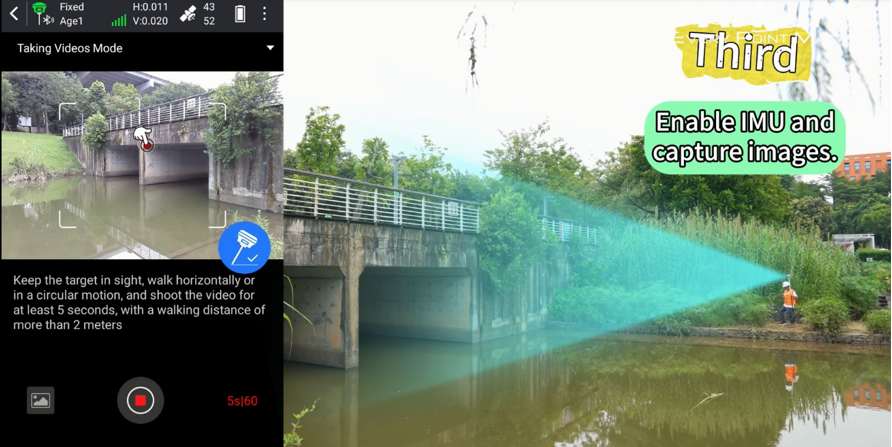
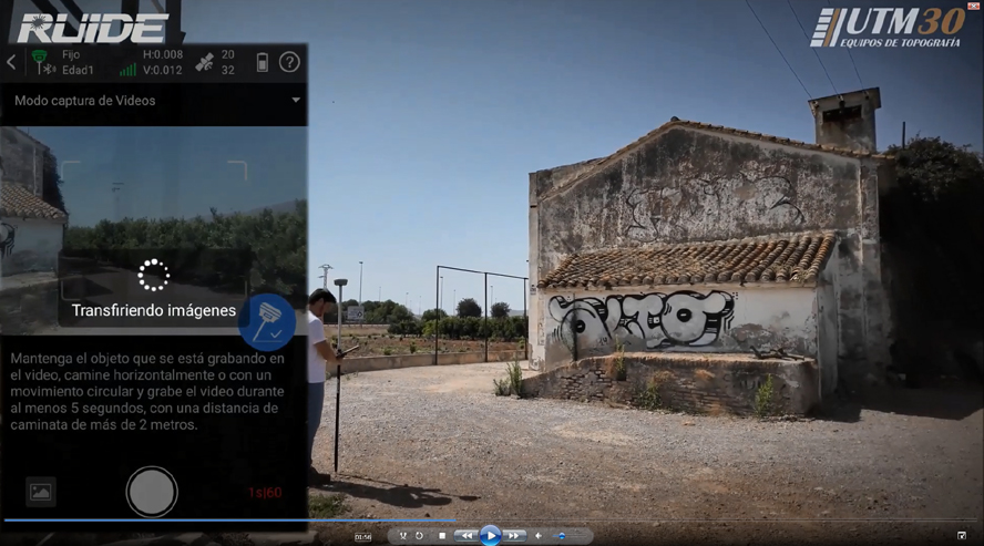
RAMA2’s advanced photogrammetry technology enable users to easily acquiring coordinates for hundreds of points within minutes, by using the 8MP front camera to shoot a video or some photos.
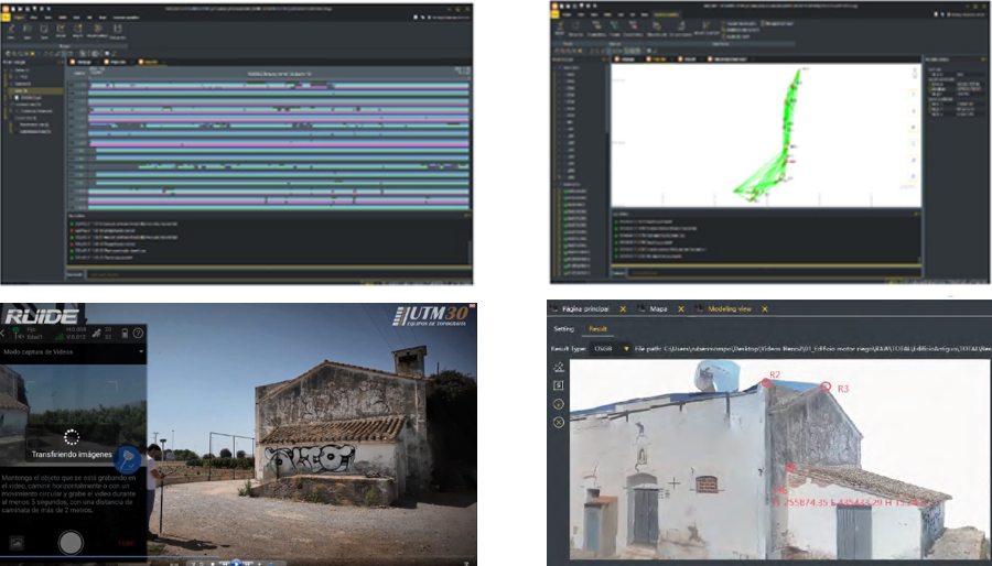
The video and photos captured by RAMA2 also can be used to process out 3D model. The data output can be used with the 3rd party designing software, also can be combined with Drone (UAV) data, such as DJI and other brands.
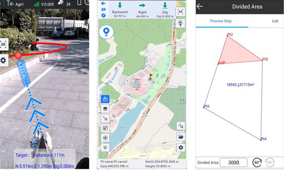
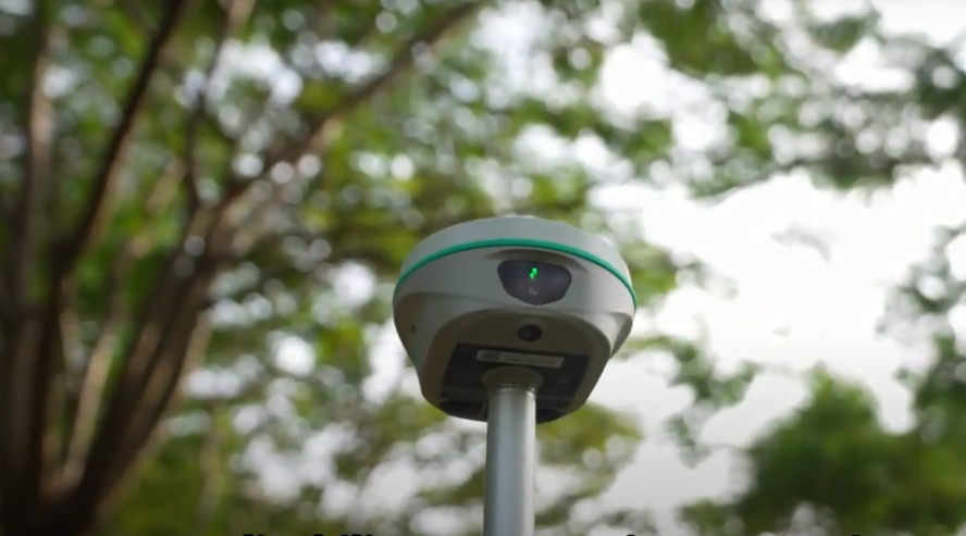
Let’s Experience the new way of Stakeout is A new 8MP front camera and 2MP bottom camera combining with AR technology provide precise direction and dynamic responsiveness. Let your intuition lead you to the right destination.
| Satellite Tracking Ability | ||
Channels1698 channels | Constellation GPS, GLONASS, BEIDOU, GALILEO, QZSS, SBAS | L-BandBDS PPP & Galileo HAS |
| Positioning Output Rate1-20 HZ | Initialization Time2-8 s | |
| Positioning Precision | ||
UHF RTKHorizontal ±8mm 1 ppm | Network RTKHorizontal ±8mm 0.5 ppm Vertical ±15mm 0.5 ppm | |
| Static and Fast-Static Horizontal ±2.5mm 0.5 ppm | RTK Initial time 2-8s | |
| User Interaction | ||
Operation SystemLinux | Screen DisplayColorful Display | wifiYes |
Voice Guideyes, 8 language | Data Storage16 GB internal, 64 GB external | Web UIYes |
| Keypad2 physical buttons | ||
| Working Capability | ||
| Laser MeasurementShooting Laser to measure coordinate & stakeout | Visual PositioningShooting photo or video to measure coordinate | 3D ModelingProcess by Post-processing software |
Visual Stakeout with ARUses Dual-Camera to stakeout pts, lines, CAD | RadioBuilt-in transmitting and receiving, 1/2 W | Tilt Survey Inertial Measurement |
| Endurance up to 16 hours (static mode), up to 12 hours (rover mode), up to 10 hours (UHF base mode) | OTG (Field Download) yes | Electronic Bubble Yes |


